


Mount Rodgers Voting District, Grayson County, Virginia
About
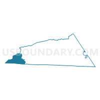
Outline

Summary
| Unique Area Identifier | 681752 |
| Name | Mount Rodgers Voting District |
| County | Grayson County |
| State | Virginia |
| Area (square miles) | 30.42 |
| Land Area (square miles) | 30.41 |
| Water Area (square miles) | 0.01 |
| % of Land Area | 99.97 |
| % of Water Area | 0.03 |
| Latitude of the Internal Point | 36.63420450 |
| Longtitude of the Internal Point | -81.55470020 |
Maps


Graphs
Select a template below for downloading or customizing gragh for Mount Rodgers Voting District, Grayson County, Virginia


Neighbors
Neighoring Voting District (by Name) Neighboring Voting District on the Map
- Voting District 06, Ashe County, NC
- Voting District 08, Ashe County, NC
- 1A Laurel Voting District, Johnson County, TN
- Green Cove Voting District, Washington County, VA
- Konnarock Voting District, Smyth County, VA
- Rugby Voting District, Grayson County, VA
- Troutdale Voting District, Grayson County, VA
Top 10 Neighboring County Subdivision (by Population) Neighboring County Subdivision on the Map
- Taylor district, Washington County, VA (7,503)
- Rye Valley district, Smyth County, VA (4,754)
- District 1, Johnson County, TN (3,425)
- Wilson Creek district, Grayson County, VA (3,331)
- Helton township, Ashe County, NC (718)
- Hurricane township, Ashe County, NC (302)
Top 10 Neighboring Unified School District (by Population) Neighboring Unified School District on the Map
- Washington County Public Schools, VA (54,876)
- Smyth County Public Schools, VA (32,208)
- Ashe County Schools, NC (27,281)
- Johnson County School District, TN (18,244)
- Grayson County Public Schools, VA (15,533)
Top 10 Neighboring State Legislative District Lower Chamber (by Population) Neighboring State Legislative District Lower Chamber on the Map
- State House District 93, NC (78,360)
- State House District 4, VA (73,375)
- State House District 5, VA (69,572)
- State House District 3, TN (60,934)
Top 10 Neighboring State Legislative District Upper Chamber (by Population) Neighboring State Legislative District Upper Chamber on the Map
- State Senate District 45, NC (184,898)
- State Senate District 40, VA (184,056)
- State Senate District 2, TN (175,067)
Top 10 Neighboring 111th Congressional District (by Population) Neighboring 111th Congressional District on the Map
- Congressional District 5, NC (693,414)
- Congressional District 1, TN (684,093)
- Congressional District 9, VA (656,200)
Top 10 Neighboring Census Tract (by Population) Neighboring Census Tract on the Map
- Census Tract 9708, Ashe County, NC (4,948)
- Census Tract 9564, Johnson County, TN (4,876)
- Census Tract 307.02, Smyth County, VA (4,219)
- Census Tract 108, Washington County, VA (3,133)
- Census Tract 9702, Ashe County, NC (2,884)
- Census Tract 9703, Ashe County, NC (2,470)
- Census Tract 603, Grayson County, VA (2,119)
Top 10 Neighboring 5-Digit ZIP Code Tabulation Area (by Population) Neighboring 5-Digit ZIP Code Tabulation Area on the Map
- 28643, NC (3,521)
- 24236, VA (3,085)
- 28615, NC (1,876)
- 24363, VA (1,365)
- 24378, VA (1,229)
- 37680, TN (766)
- 24292, VA (535)